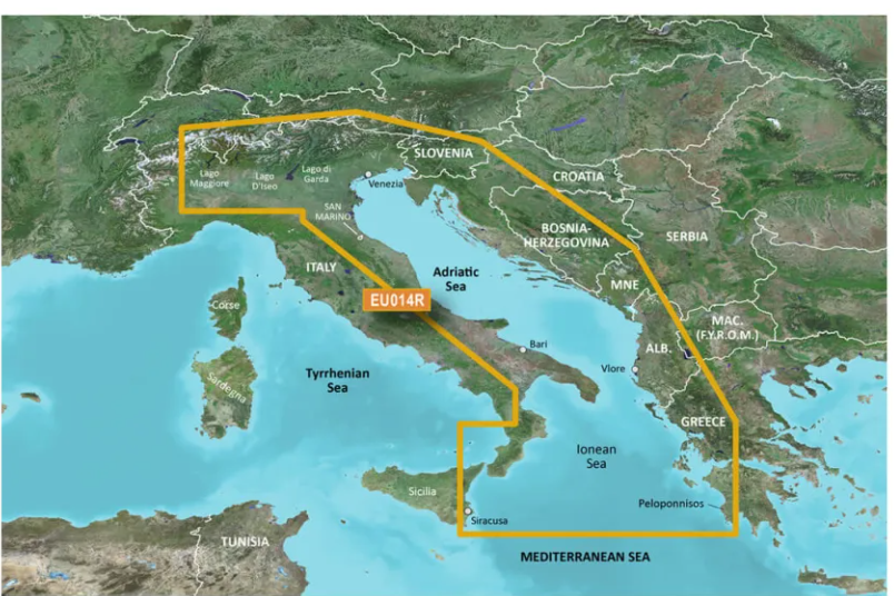


NAVIONICS HXEU014R G3 ITALY - ADRIATIC
Couldn't load pickup availability
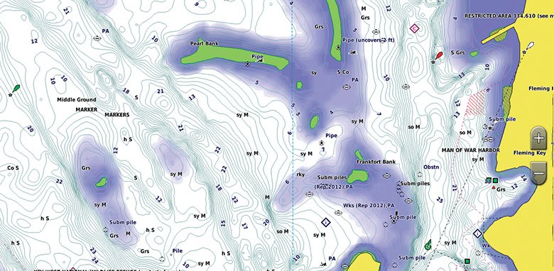
- Provides industry-leading coverage, clarity and detail with up-to-date coastal charts that include integrated Garmin and Navionics® data
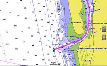
- Auto Guidance Technology 1 calculates a route using the desired depth and height and suggests a path to follow
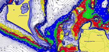
- Includes depth shading for up to 10 ranges, allowing you to see target depth clearly
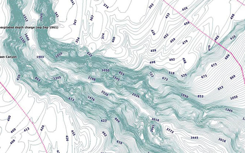
- Depth contours down to 30 cm provide a more precise view of bottom structure to create optimized fishing maps and enable navigation in wetlands, canals and marinas.
BlueChart g3 coastal charts provide industry-leading coverage, clarity and detail with integrated Garmin and Navionics data. Also included is Auto Guidance 1 , which uses your desired depth and elevation to calculate routes and suggest a path to follow — displayed overlaid on the chart. NOAA raster cartography is also available as a free downloadable feature through the ActiveCaptain app. It provides your chartplotter with paper-map-like views of NOAA surveyed areas, with individual points of interest labeled with their longitude and latitude information. Global coverage is available by region as accessory cards or via download; each region sold separately.
Auto Guidance Technology
The Auto Guidance function 1 calculates a suggested route using the desired depth and vertical clearance.
Depth shading
This feature displays high-resolution depth range shading for up to 10 ranges so you can view the distance to your designated target.
Detailed bathymetry
BlueChart g3 charts include 12-inch contours that provide a more precise description of bottom structure to create improved fishing maps and increase detail in marshes, canals and port facilities.
Shading of shallow waters
To aid navigation, the Shallow Water Shading feature displays map shading at a user-defined depth to give a clear picture of shallow water areas to avoid.
Le spedizioni per l'Italia avvengono in 2-6 giorni lavorativi. Il costo è di €9,99 per i pagamenti effettuati con carta e di €14,99 per pagamenti con contrassegno.
Le spedizioni per i paesi UE avvengono in 4-9 giorni lavorativi. Il costo è di €30. Non è possibile effettuare il pagamento con contrassegno.
Le spedizioni per i paesi Extra UE avvengono in 6-10 giorni lavorativi. Il costo è di €50. Non è possibile effettuare il pagamento con contrassegno.